26th December, 2006
Hawaii!
Well it was time to (reluctantly) leave Canada and return home to Australia. But instead of crossing the Pacific in one flight I decided to spend 9 days exploring some of the Hawaiian islands. Coming from a Canadian winter, it was a bit of a shock when I hit the equatorial temperatures and intense humidity.
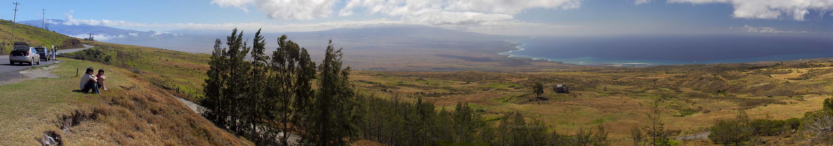
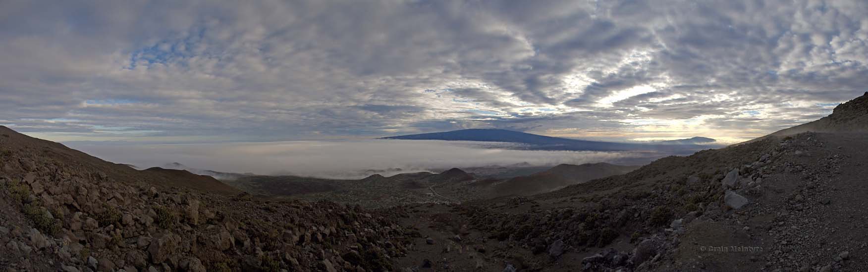
Above: Scroll right for a panorama of the western coastline of the big island of Hawaii. The mountain on the far left background is the volcano Mauna Kea, which is home to the worlds largest optical telescopes. This side of the island is really quite barren as it is the dry side. This is in stark contrast to the eastern side of the island which is much more rainforest like.
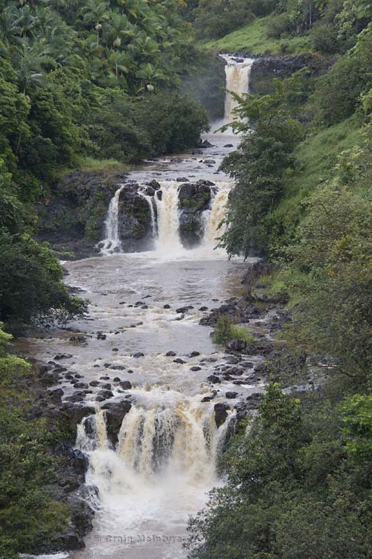
Below: Umauma Falls on the rainy eastern side of the island.
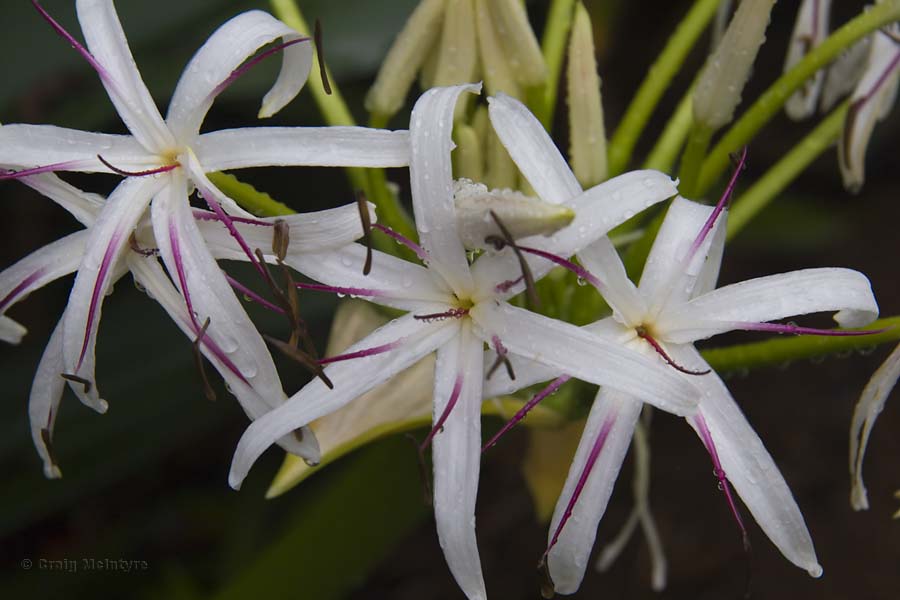
Above & below: Every bright flower seemed to stand out to me having gone from a cold desolate winter to the tropics.

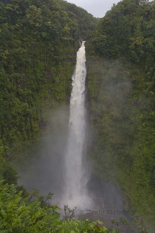
Above: Water tumbles down a 420ft (128m) vertical drop over Akaka Falls. This drop is approximately the height of the top of the Sydney Harbour Bridge above sea level.
Below (scroll right): The second biggest volcano on the island of Hawaii, Mauna Loa, rises above the lower clouds nearing sunset. As seen from Mauna Kea, the biggest volcano on Hawaii.

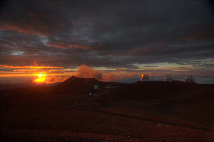
Above: Sunset on top of the Mauna Kea volcano with the 8.2m Subaru telescope (left) and the twin 10m Keck telescopes - the largest optical telescopes in the world.
Below: A Mauna Kea sunset at 13,796ft (4,205m) with clouds above, below and in front of us. If you measured from it's base on the floor of the Pacific Ocean, Mauna Kea would be the tallest mountain in the world standing at 33,500ft (10,200m).

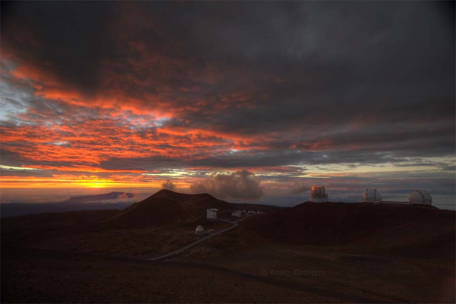
Above & below: The last rays of sunshine strike the volcano-top observatories. The desolation of the top of a volcano really felt like being on a totally different planet.
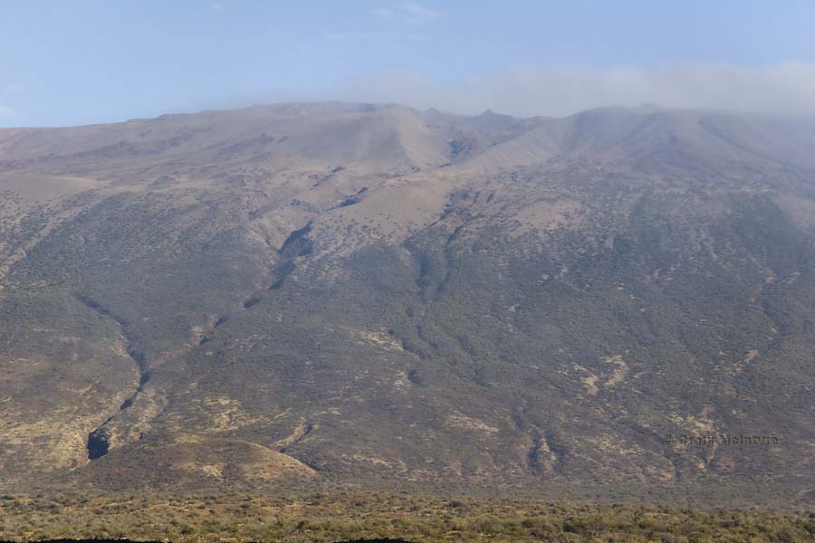
Above: The channels seen running down the side of Mauna Kea in this image are not caused by volcanic activity. Instead, they are actually erosion channels caused by the runoff of glacial meltwaters. Yes, glaciers once existed on the tallest peaks of the Hawaiian islands! In fact, the name Mauna Kea means "white mountain" as it is tall enough for snow to fall on it during the cooler months.
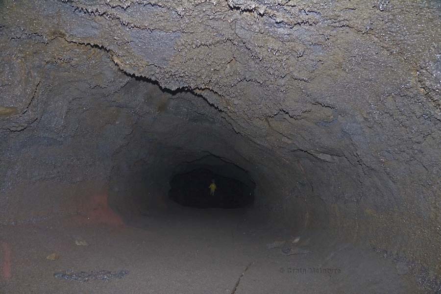
Below: A very dark and damp lava tube. It's amazing to think of the forces involved that created this, and the river of red-hot molten rock that once flowed through here.

Above: The Kilauea Iki crater is a smaller crater lying next to the main summit caldera of Kilauea (seen in the far background). A walking trail can be seen worn into the surface of the lava lake that erupted in 1959. The ground is still warm, 50 years after it errupted and steam still rises from some parts.
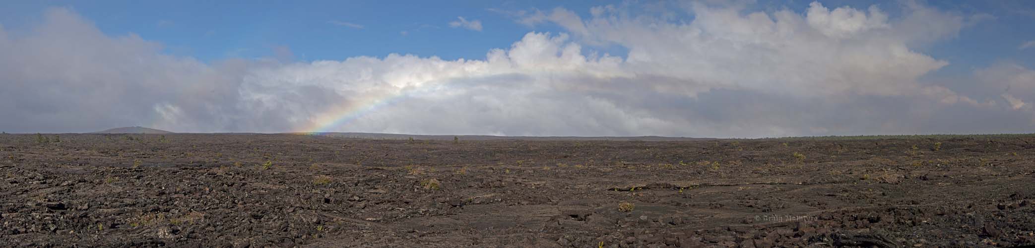
Below: Lava flows dessimate the landscape in the short term before eventually becoming immensely fertile. In the mean time, a few small plants make a scratchy life on these barren fields.
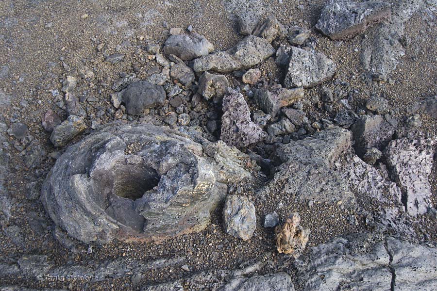
Above: Walking across an old lava field you would occasionally come across holes in the rock like this. These were caused by tree stumps that didn't burn away completely under the intense heat of the lava due to the moisture locked up inside the tree.
Below: A large tree branch had been placed into one of the stump holes left behind after the lava cooled.

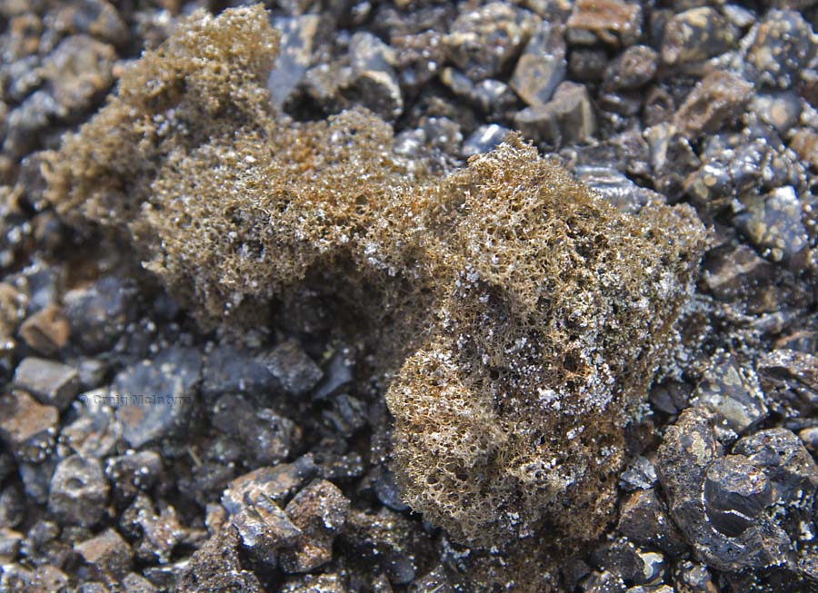
Above: There are a few different types of lava flows one can encounter, but this picture shows the less commonly seen cinder variety. It resembles somethin akin to pumice as it is very light and not very dense. In the hand it will crumble with the slightest pressure.
Below: Steam rises where lava enters the sea, expanding the size of the big island of Hawaii.
