Friday 28th April, 2006
The Icefields Parkway runs from Lake Louise (about 2 hours from Calgary) to Jasper for 230km. It has been described as one of the best drives in the world and it's not hard to see why.
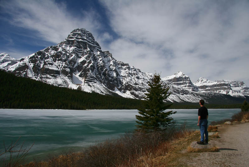
Above: Mt Chephren (3266m / 10716') and the partially frozen Mistaya Lake.
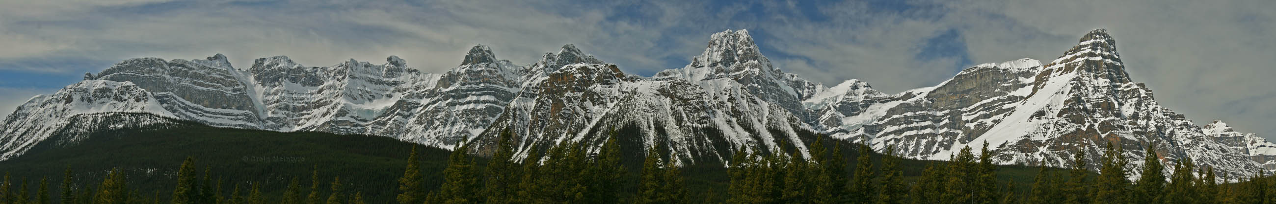
Below: A panorama of peaks along the Icefields Parkway. Mt Chephren (from the first image) is the prominent peak on the right hand side.
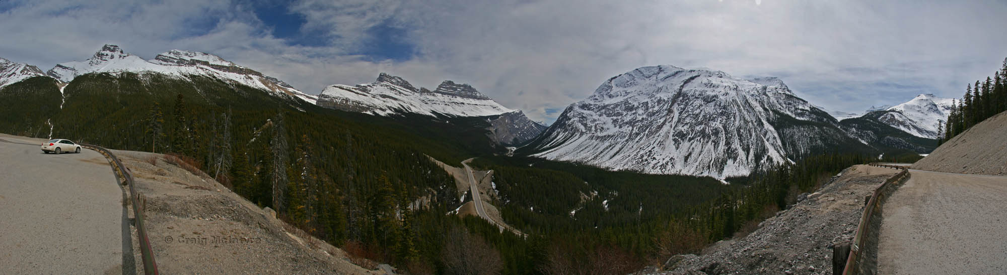
Above: The view from “Big Hill” down onto the Icefields Parkway between Lake Louise and Jasper.
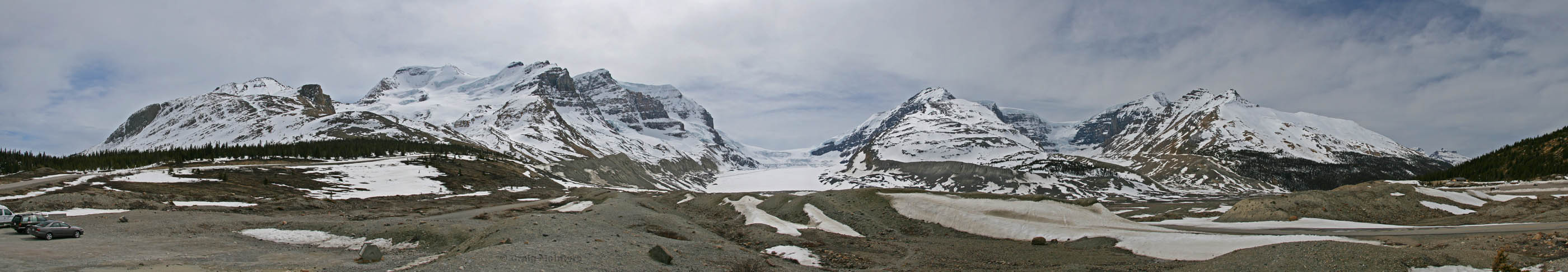
Below: Near the foot of the Athabasca Glacier that flows out of the Columbia Icefield. This is a bit over halfway from Calgary to Jasper. The Columbia Icefield is a massive basin of ice behind these mountains and numerous glaciers flow out of it as it accumulates with snow.
From the left is Hilda Peak, Mt Athabasca and Mt Andromeda (mostly behind Mt Athabasca), then the Athabasca Glacier. To the right of the glacier is Snow Dome and the Dome Glacier, followed by Mt Kitchener and (in front of it) Mt K2. Snow Dome is one of only two peaks in the world that is a triple continental divide. Water running off the top of it flows tho three oceans - through the Saskatchewan and Nelson Rivers to the Atlantic, through the Columbia River to the Pacific, and through the Athabasca, and eventually the Mackenzie River to the Arctic. Snow Dome is the hydrographic apex of North America.
The piles of dirt in the foreground of the picture in front of the glacier is one of its terminal moraines. This is where the glacier has pushed the dirt and earth during one advanced until it started receding. The terminal moraine from the longest advance sits a good 500m behind the camera in the car park across the highway (yes, there are big piles of earth in the car park!).
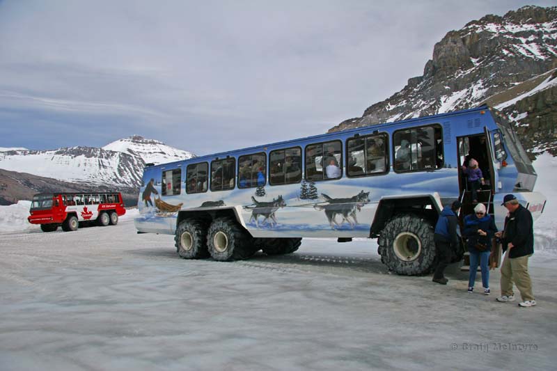
Above: One of the giant Ice Explorers that transports you onto the Athabasca glacier which flows out from the Columbia Icefield. This is only a small glacier, measuring 6km long and 1km wide. The Columbia Icefield is one of the biggest south of the Arctic Circle.
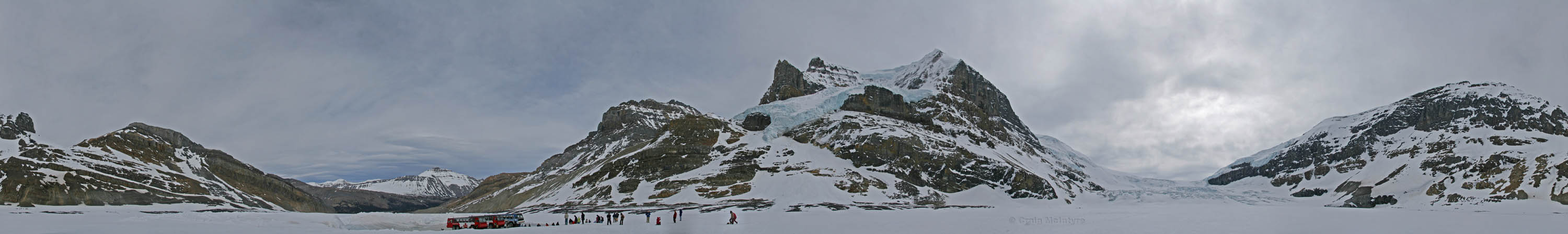
Below: A 360 degree panorama from on the Athabasca Glacier. Cracks and crevaces can be seen in the glacier as it flows out from the Columbia Icefield and over a hill (far right) a couple of kilometres away. Another glacier, this one bluish, can be seen creeping over Mt Andromeda. The Ice Explorer buses are parked on a graded section of the glacier. It must be graded each day due to the glaciers movement (about 25m/year midway along the glacier).
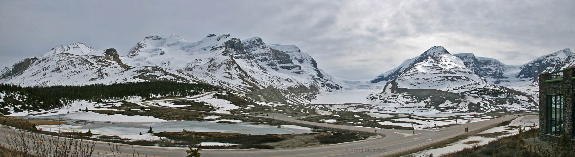
Above: Another panorama of the Athabasca Glacier from the Icefields Visitors Centre.
Below: View of the Athabasca Glacier (right) and Mt Athabasca (centre, behind clouds) after hiking up to the top of Wilcox Pass. Not long after this shot I got snowed on whilst having lunch.
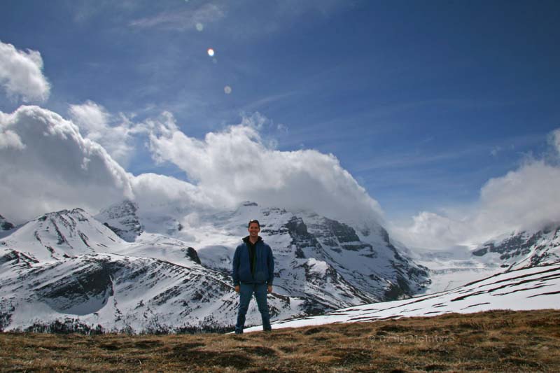
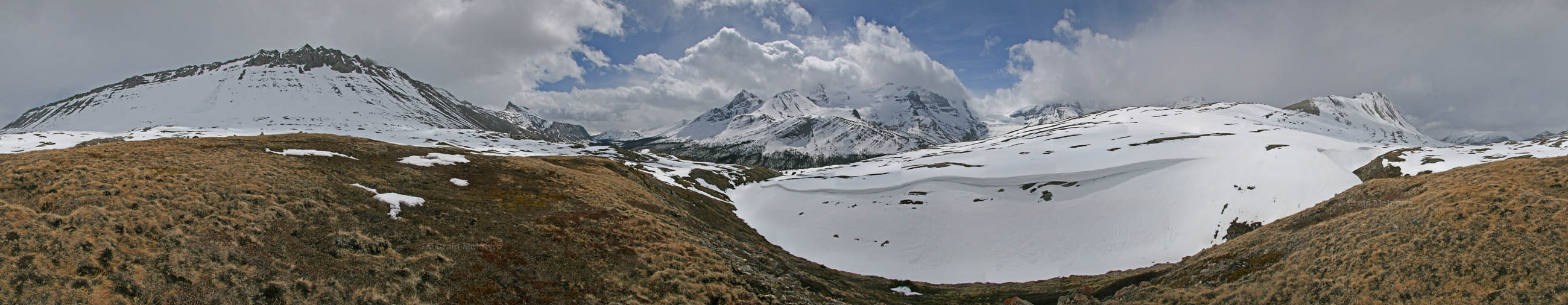
Above: A 360° panorama from Wilcox Pass.
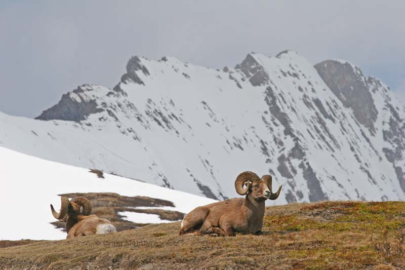
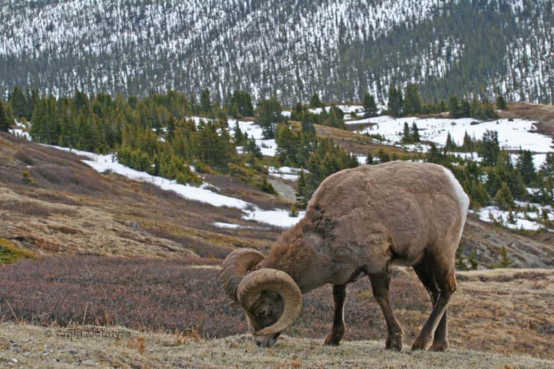
Below: Bighorn Sheep on the trail near Wilcox Pass. I almost walked into these guys as they were munching on grasses on the other side of a crest. Despite being 3m away they didn't budge an inch, though with horns like that they didn't need to! Mt Wilcox is in the background.
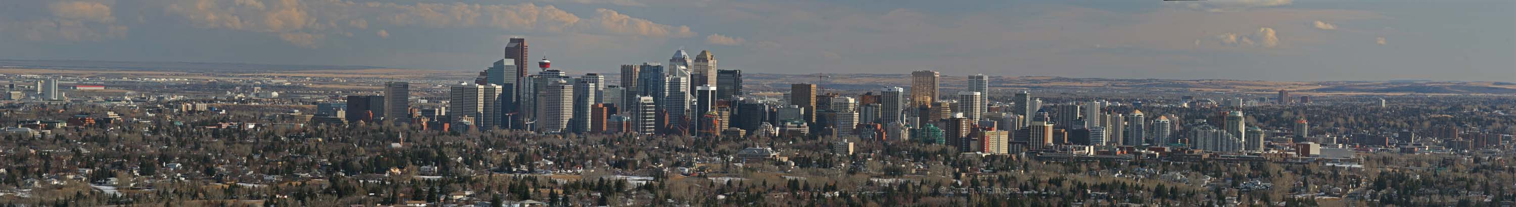
Above: The city of Calgary on a beautiful spring day. It reached a whole 7°.
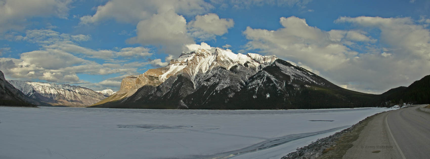
Below: Lake Minnewanka frozen over and Mt Inglismaldie (2964m). The lake is 24km long and 146m deep.
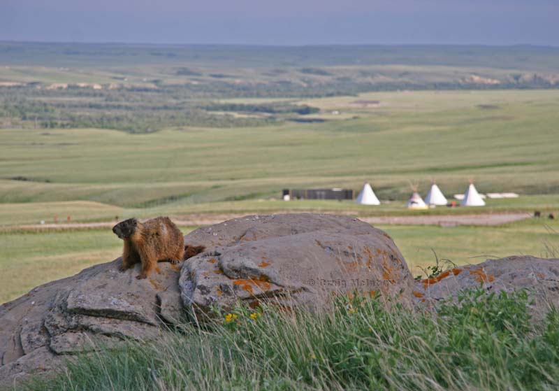
Above: A marmot surveys the land at the site of Head Smashed In Buffalo Jump, where natives once guided herds of buffalo off a blind cliff before butchering them at the bottom.
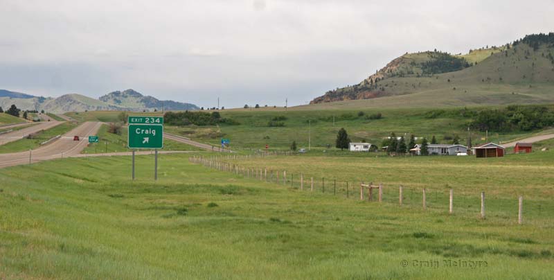
Below: I couldn't pass up a photo of this now could I? There really wasn't too much more to the town than a couple of sheds and buildings. Taken in northern Montana on my way to Yellowstone National Park.